
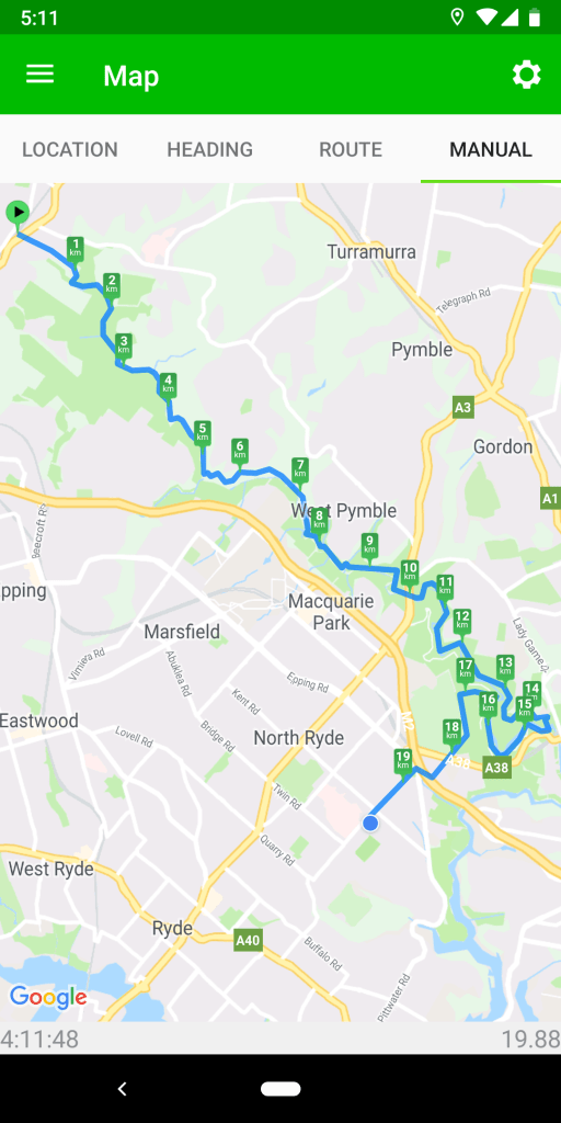
Lane Cove Valley, Thornleigh to North Ryde
May 3, 2019
The sounds of the birds hit us as soon as we enter the bush behind Thornleigh Oval – first the bell miners, white cockatoos, currawongs and a couple of others I can’t quite identify. As we descend further into the valley, we start to hear whip birds as well, but it is the bell miners whose chiming calls dominate the air for the next couple of hours.
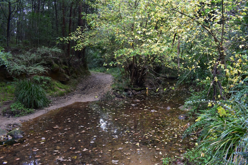
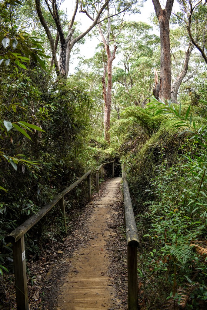
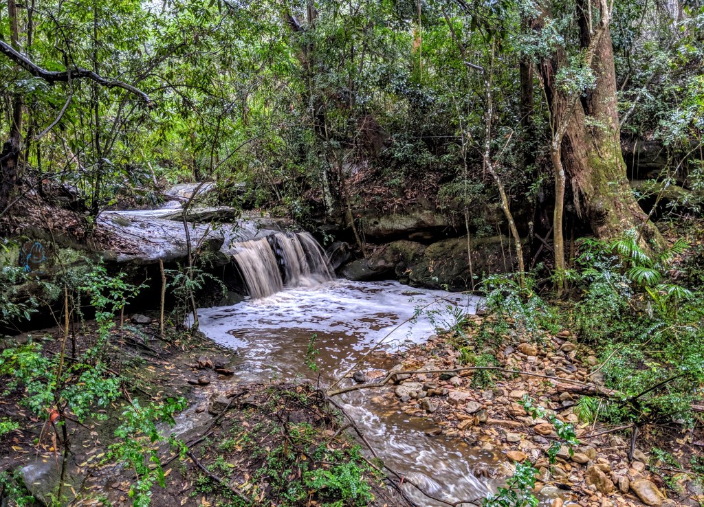
The descent into the valley at the start is steep in parts but the track is good and it’s not long before we hit the valley floor. It’s more fire trail than bush track here, and easy walking generally. There are a couple of creek crossings, but water flows are low – for now.
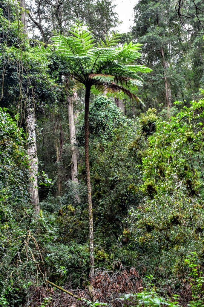
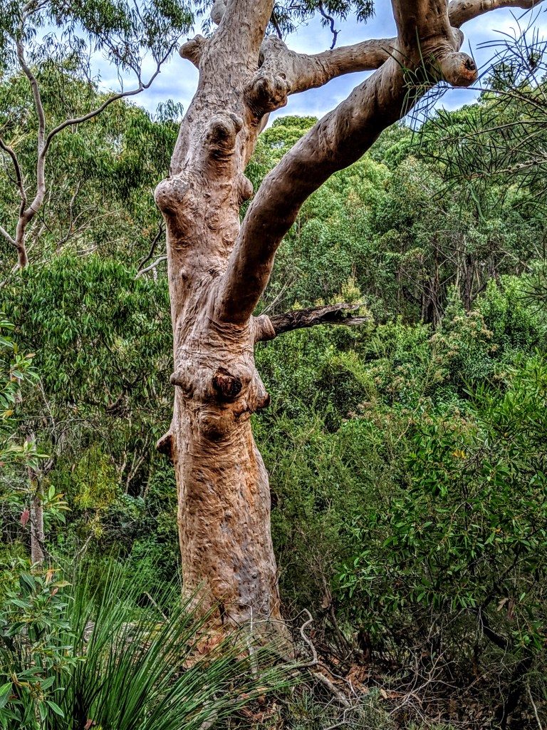
This stretch of the Great North Walk is another old favourite, because it runs through the suburban bushland where I grew up. Better tracks and increased urban run-off aside, it’s much the same as I remember from my early teens and younger – a wet schlerophyll forest populated by soaring blackbutt, blue gums, angophoras and turpentines.
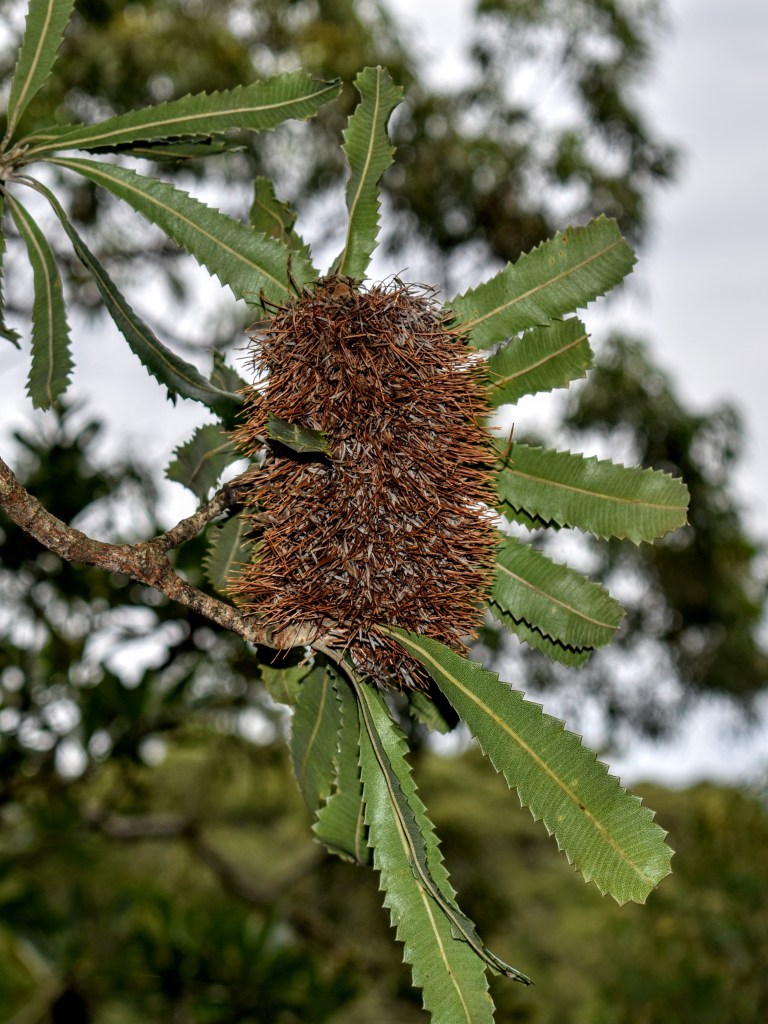
The understory has been invaded by lantana, privet and a bunch of other unwelcome guests, but the natives hold their own, including acacias, grevilleas, brush kurrajongs and a variety of ferns.
The track follows the headwaters of the Lane Cove River, nestled in a green belt between Turramurra on one side and Epping on the other. The M2 Motorway isn’t far away, but we rarely hear its traffic.
Before too long, we’re passing between West Pymble and Macquarie Park, and arrive at De Burgh’s Bridge – or under it, at least. We’re 10ks in, and take a break to check the weather app – there’s a big rain front heading our way, so I pack the camera away and we don our wet weather gear.

As the rain comes down, we enter Lane Cove National Park, and the track hugs the side of the ridge rather than the riverbank. There are a couple of overhangs along the track, so we head there to take our lunch break, where we find a couple of Soil Conservation track maintenance staff doing the same thing.
The track is narrow but well-defined – and courtesy of our lunchmates – well-maintained. It’s nice bush and nice walking, and you could forgot that there are houses within hundreds of metres.
We head down again, skirting the river, and this stretch is eastern water dragon central. In the low light and rain, they suddenly appear underfoot or leaping across the track from rocks. With no sun, there aren’t as many of these lovely lizards as I saw a few weeks prior on the other side of the river, but the community is obviously healthy.

There are a couple of options once we’re back on the ridge – head down again to connect with the roadway and picnic areas, or upwards – which is the actual GNW route. My preference is mostly to head up because I can stay in the bush longer, plus it’s just a more pleasant walk.
After wandering through the she-oaks, we arrive at park headquarters and recaffeinate at the café, which is surprisingly busy given the weather and location. We then part ways, my mate heading for Chatswood station, while I head across the weir towards home.
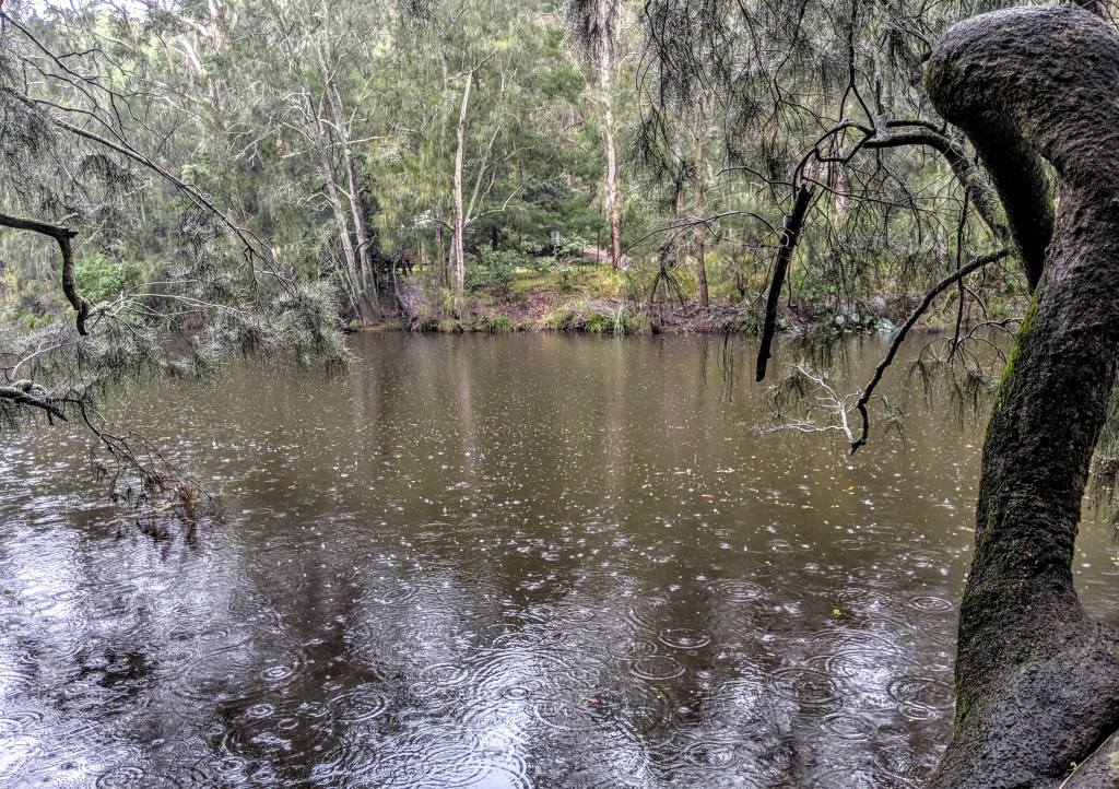
This gives me the opportunity to head upriver on the opposite bank, a familiar but always enjoyable path. Not surprisingly, I don’t come across any other walkers, but I see several water dragons.

Once I reach the Halfway Point picnic ground, I head uphill, exiting the park alongside the caravan park and walk along Plassey Rd – the cemetery to my right – and return to civilisation. Up ahead is North Ryde railway station (currently non-operative as it converts to the metro) and the high-tech business park.

My Akubra is dripping now, but it really hasn’t been unpleasant walking in the rain at this time of the year. And a hot shower and a cold beer awaits at home.

Leave a comment