
Kanangra to Kowmung via Brumby & Roots
May 25-26, 2019
- Distance: About 28km round trip
- Ascent/Descent: About 1300m each
- Wow Factor: Extreme
- Pain Factor: Pretty High
How good is the Kowmung? It’s exceptional, and how any politician or bureaucrat could consider drowning this beautiful wild river to facilitate more suburban housing is beyond comprehension. But more of that later.
The Kowmung River has a slightly exalted status in bushwalking circles, not just because of its ecological and picturesque qualities. It is a true wild river, rising deep in Kanangra-Boyd National Park, snaking its way to join Cox’s River, which then flows into Lake Burragorang and Warragamba Dam – Sydney’s water catchment.
Like most of the more interesting destinations in Kanangra-Boyd, it is fairly inaccessible. The only way in is by foot, and even getting to the entry points requires a level of commitment that deters the Instragram tribe. I hadn’t visited the Kowmung since my late teens, and it’s fair to say I’d forgotten how rugged this country is.
We left Sydney mid-afternoon, but it was inky dark once we arrived at the Boyd River campground after negotiating the twisting bends either side of Jenolan Caves, then the dirt roads along Kanangra Walls Road. Fire lit, tents up, wine poured and a sky littered with stars, all was well with the world.
Daylight revealed the full magnificence of the plateau campground which sits under towering eucalypts (and much improved since my last visit 35 years ago). After the usual final decisions about what to pack or leave, we pointed the vehicles to Kanangra Walls and the trailhead.

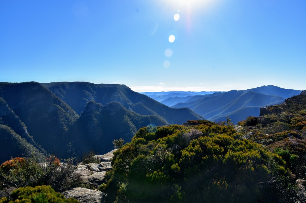
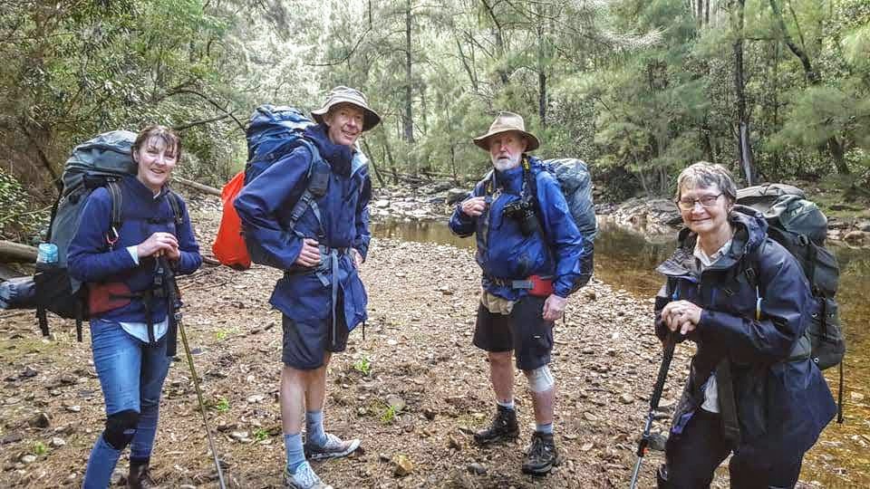
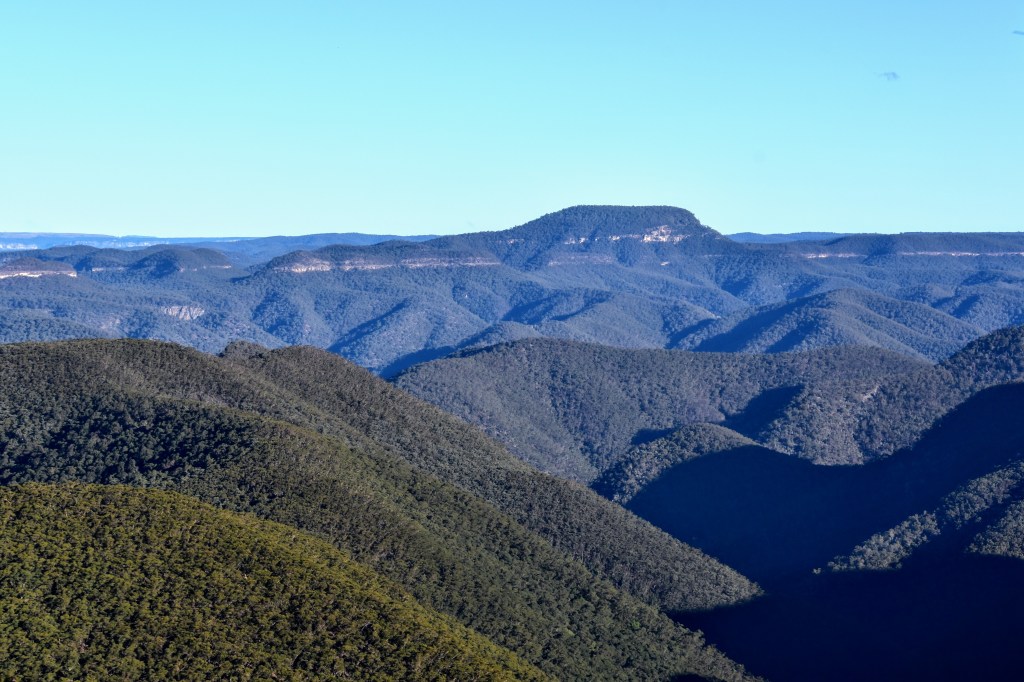
Three men and two women – all in our fifties and nearly all with varying degrees of knee problems – we hit the Plateau Track with enthusiasm, descending well-spaced steps to check out Dance Floor Cave before climbing again to the plateau to enjoy panoramic views north to Katoomba and in every other direction.


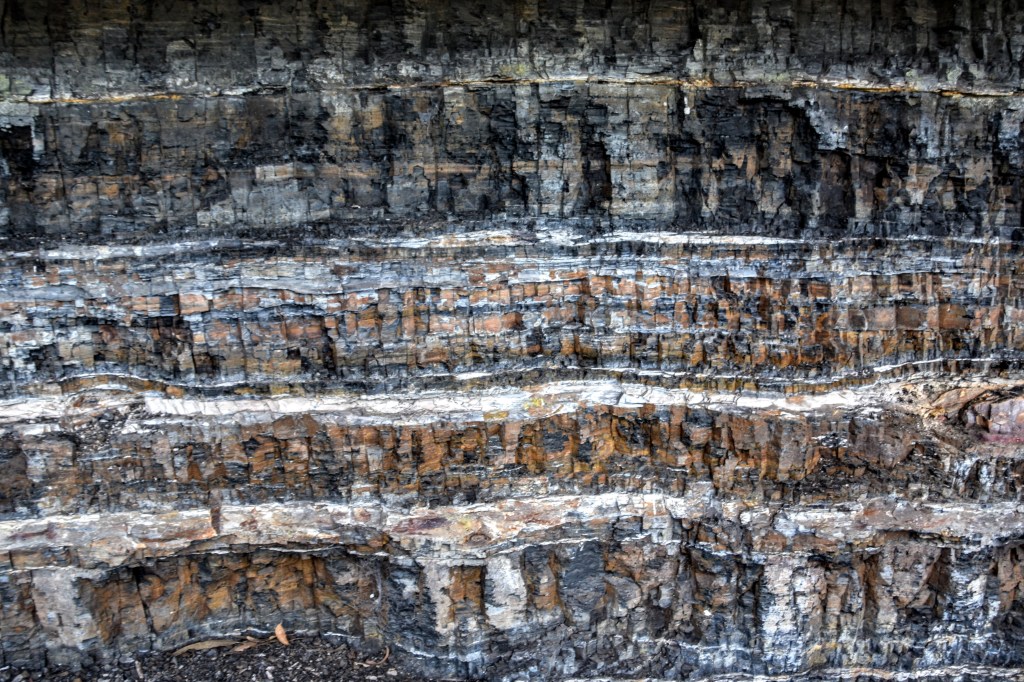
It’s not long before we’re deep in banksia scrub a metre or so above our heads. The track is narrow but well-defined, at times feeling like you’re ploughing through a tunnel. After a little time trying to calibrate some inconsistencies between our topo map and the GPS, we duck below the bluff and find ourselves at Coal Seam Cave, where we stop for a break and to enjoy the geology.

We pick up the Gingra Track, negotiate a slightly tricky traverse around Cottage Rock, then continue until we reach First Top Mountain – thankfully there is a small cairn to indicate the right-hand turn.
The track down Brumby Ridge is not “marked” on our maps, but we’ve established through online research that it’s well-travelled, and fairly straightforward so long as we avoid veering down Mistake Spur. Seems like good advice.
After finishing lunch on First Top Mountain, we’re just about to head out when three very fit 20-something blokes arrive. They’re about to break as well, so after chatting about the route down Brumby Ridge, we depart.
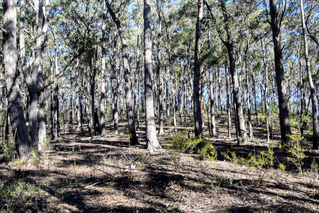
The start of the track isn’t clear, but we zigzag until we pick up the trail, and following the spine is pretty straightforward. It’s fairly open, populated by eucies and some low scrub. We’re immersed in the sounds of bell miners and whipbirds as we continue to Brumby Mountain.
From here, there’s a relatively gentle walk down the spur, but as we hit the 400m contour, it gets steeper. The ground is dry, loose, rocky and covered with lots of leaf litter. There is lots of fallen timber – as there has been all day – which forces deviations off the natural track.
It’s slow and steady going for all of us. Around the 300m contour, the young fellas catch us up, and move past. They offer to gather firewood for us, but ultimately we find separate campsites.
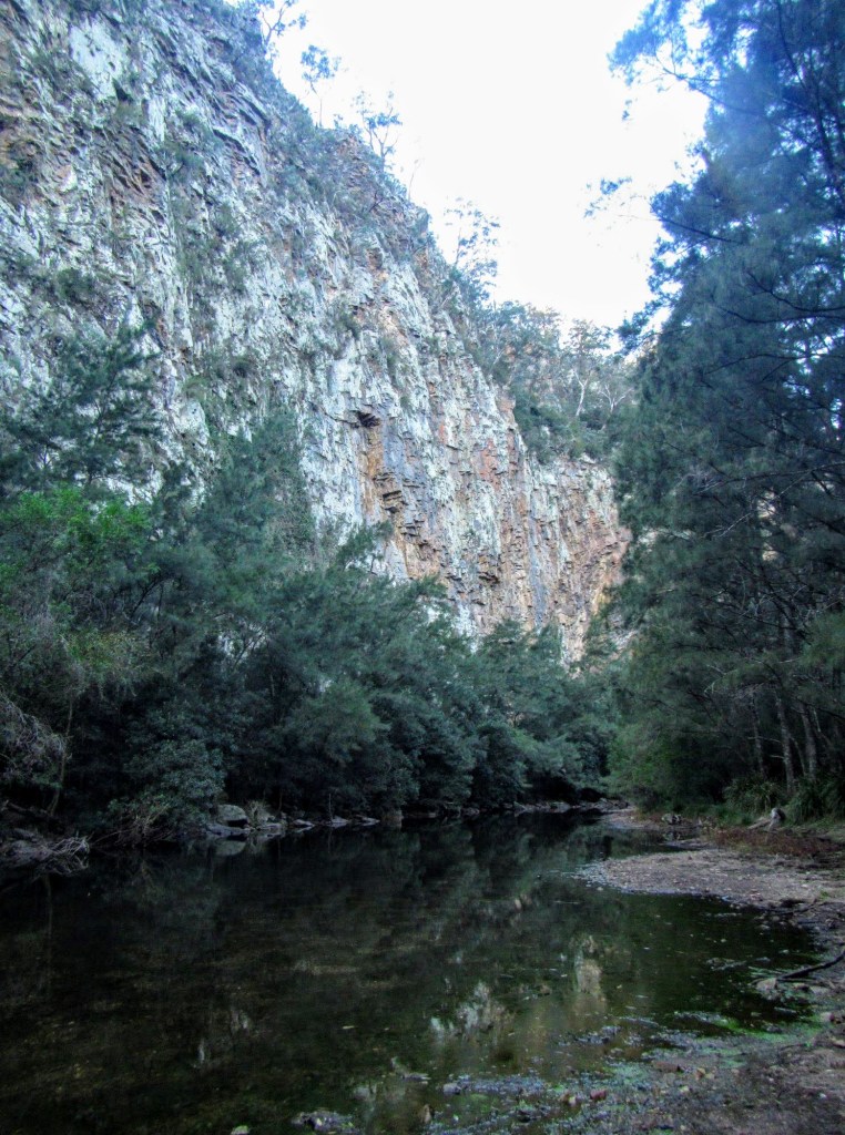
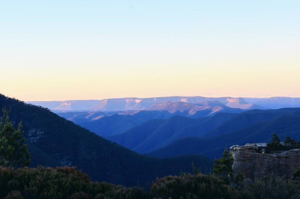
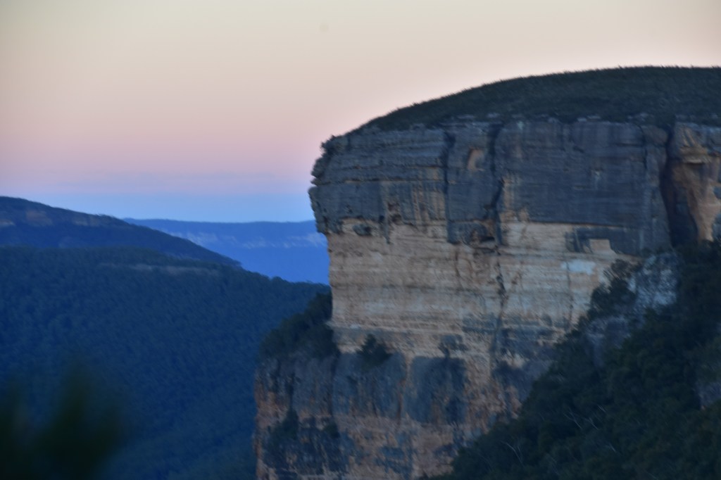
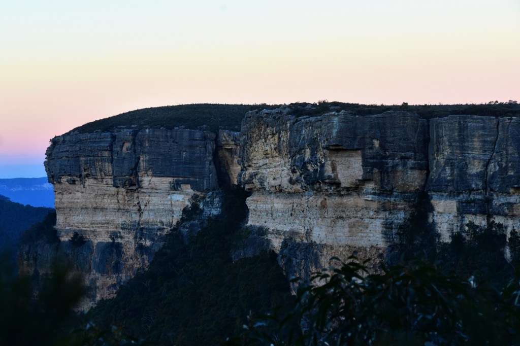
The gradient steepens, and my knees are on fire, and some of my mates are feeling the same. But in time, we hit the bottom,and set up camp. Unfortunately, we’ve missed the late afternoon sun on Orange Bluff on the other side of the Kowmung River, but even in shadow it’s impressive.
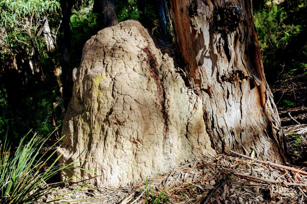
We get the fire underway. For me, this is what makes it worthwhile. We cook and eat dinner, trade stories, share chocolate and other snacks, and stare up at the Southern Cross, almost lost among the myriad smaller stars we never see in the city. One of the young blokes comes across to make sure we’re OK, but we don’t get a visit from any of the wombats whose tunnels are scattered around the edges of the campsite.
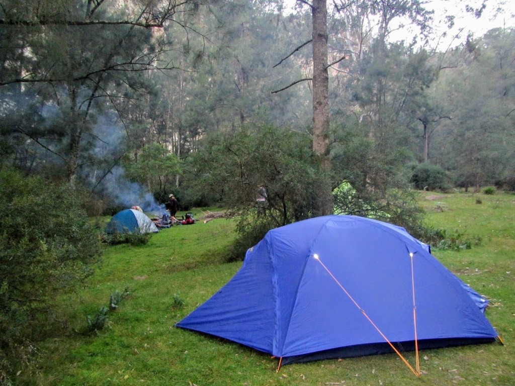
Bedtime is early. We’re all tired, and we’re planning for an early start in the morning.
We’re woken by wind in the ridges later in the night, but it’s a light rainfall which wakens us in the morning. It’s not a big deal, but it means that we have to pack wet tents and gear up in rain jackets for our walk downstream.

The Kowmung is a flat, low river. The ongoing drought has reduced its flow, but it’s still alive. Algae gathers in some stagnant sections, while the banks are churned up by feral pigs in too many places. While no longer pristine, its beauty remains, trickling over the rounded river rock at times, at other times deepening and widening as it rounds the ridges dropping to the valleys.
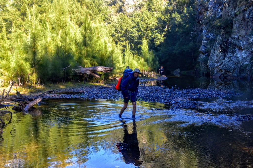
We cross the river several times to follow the easiest route, variously stepping gingerly over the slippery river rocks, pushing through spiky scrub and sword grass, and occasionally walking through open grass areas characterised by multiple wombat holes. Only one of our party slips in the water, and a couple even manage to keep their feet dry by navigating depths lower than their boot tops.
Despite the light rain and wet scrub, it’s beautiful walking, and after a couple of Ks we arrive at the base of Roots Ridge. After pausing to don dry socks and recharge the batteries, we’re ready to start the ascent.
The ridge rises steeply and quickly from the valley floor, and there’s no clear track. We scrub-bash our way up and across until eventually we pick up a faint track, which we follow until the spine narrows to just a few metres, leaving us in no doubt that we’re on the right path.
Progress is slow but steady. One of our party lends me a hiking pole, and I’m impressed with how much difference it makes. Every now and then the ridge flattens and drops down into a saddle, stealing back some of our precious metres gained.
After lunching in one of these saddles, we tackle the final climb and intersect with the Gingra Track. The climb from the river has taken about three hours, and after another K or so, we’re back at First Top.
Back in familiar territory with fewer dramatic ups and downs, we settle into a good pace as we’re hoping to reach the car park before dark. While the views are familiar, they’re somehow different in the afternoon light.
Once we reach the plateau, we’re buffeted by a cool wind, but we’re treated to spectacular colour changes across the wilderness as the sun sinks. Right on sunset, we reach the cars – exhausted but exhilarated.
One of our motivations for this walk was to see the Kowmung before it is flooded. The NSW government plans to protect the Nepean River floodplains by raising the Warragamba Dam wall by 17 metres, potentially destroying some 65 kilometres of wild rivers through Kanangra-Boyd as the catchment expands.
This part of the Kowmung shouldn’t be impacted, but the lower reaches will be, as will the Cox’s and Kedumba Rivers. Not only would it be an environmental tragedy, it is quite likely that the area would lose its World Heritage status. You can learn more about the fight to protect the area on the giveadam website.
We only covered a few kilometres of the Kowmung. We’re already planning routes for our next trip/s.
Footnote: Regular visitors might think I’ve transgressed on a couple of my guidelines here:
- This is a very long post. I know, but I just thought some readers would enjoy the detail as well as the photos.
- This ain’t exactly Sydney Harbour. True, but it is part of the Sydney catchment, so I’ll occasionally take a pretty liberal view of the definition of the Emerald Edge.

Leave a comment