Up Middle Harbour Creek with a Paddle
June 14, 2019
The water is flat and glassy green, reflecting the eucalyptus forest on the hillsides around. When I draw the paddle from the water, the silence is absolute, apart from the occasional raven call. I am truly on the emerald edge. While I’m still in the middle of suburban Sydney, I could be in the middle of nowhere.
This is the beauty of the Sydney and its harbour – it is so easy to escape the rat race and find total solitude, without having to travel vast distances. Middle Harbour is an area that I’m familiar with, but I’ve never really explored it on foot or by water.
My trip starts at The Spit, Mosman, which separates the northern beaches – sometimes known as the “insular peninsula” – from the wealthy harbourside suburbs north-east of the Harbour Bridge. The Spit Bridge opens at regularly-scheduled times to allow yachts and larger launches to pass between the moorings upstream and Middle Harbour “proper”, which opens to the Tasman Sea and all points beyond.
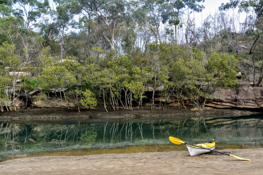
My Mirage 582 hired from Sydney Harbour Kayaks draws mere centimetres and my head sits about a metre above the waterline, so there’s no need to raise the bridge. After setting up the rudders to suit my leg-length, I’m off out through the marina, dwarfed by millions of dollars of mega-yachts.

Passing under the bridge, I travel upstream. There are moorings on both sides, megabucks worth of marine craft tethered to buoys. I shouldn’t bang on about this, but I can’t comprehend how many dollars are tied up at moorings rather than out enjoying these lustrous waters. Yeah, I know it’s a workday, but even on weekends I only ever see single percentages of the boats on the water, as opposed to at mooring.
Multi-million dollar mansions are clinging to the hills on all sides. I see a bobcat working on a near-vertical worksite, clearing the way for a new one. The house will no doubt be spectacular when it’s finished, as will the views across Middle Harbour. I envy their outlook – certainly not the mortgage!

I can see the office towers of North Sydney – where I once worked – off to my left, but it doesn’t take long to leave this all behind. Drawing on ingrained habits of my youth, I line up the kayak’s nose on each point, tracking the shortest course.

I leave behind the suburbs of Castlecrag and Seaforth, round Yeoland Point, and it doesn’t take long before I can see nothing but water and trees. Sure, there’s the odd house sticking out through the bush, but at water level, it’s just me, the boat, and nature.
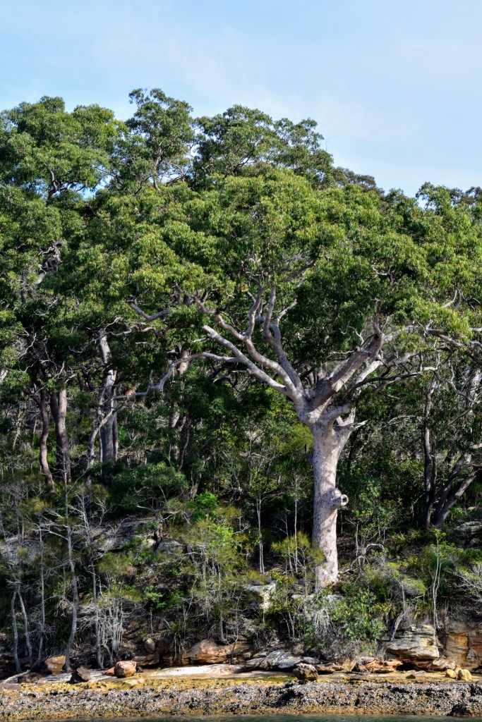
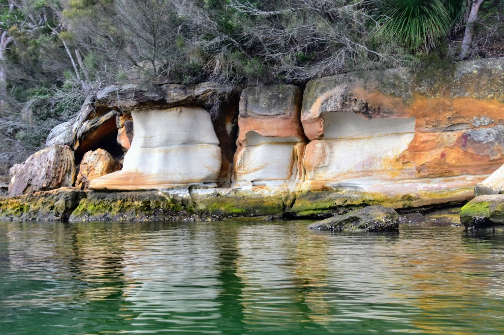
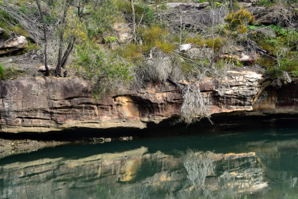
The wind-sculpted outcrops of Hawkesbury sandstone on the shoreline remind me of my youth paddling on Cowan Creek, which is not surprising as it’s all part of the same ecosystem. The slopes are populated by angophoras and blackbutts, as well as banksias, she-oaks and the occasional native grass tree.
As I continue upstream, I pass more moorings and a handful of craft on the move – fishing tinnies and a couple of working boats. There are a couple of folks fishing from the shoreline just past the Roseville Bridge, but from there on I have the river completely to myself.
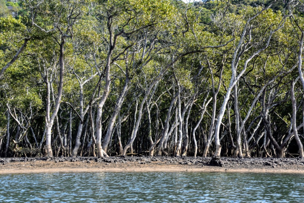
Once past Davidson Park, the river begins to narrow and the mangroves take over the shoreline, sitting above the sandbanks as it’s low tide. They look healthy, which is a great sign given they feed off so much urban run-off.
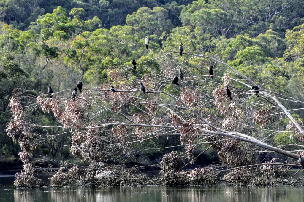
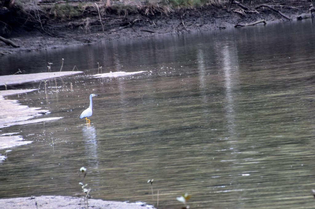
And it is beautifully silent, apart from the birds. I hear kookaburras and whip birds – they seem to be everywhere in urban bushland these days – and after rounding a bend I come across a flock of black cormorants roosting on a fallen gum tree. They are unperturbed by my presence.
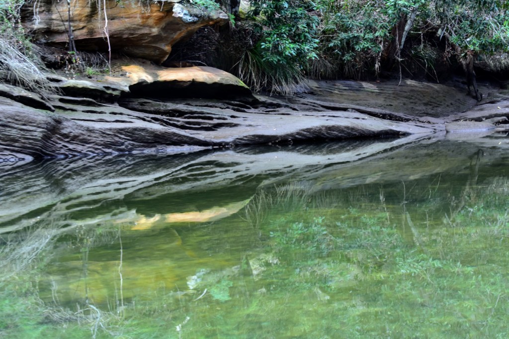
The creek continues to narrow and takes a sharp left turn. According to the map, East Killara is on my left and Davidson is on my right, but as far as I’m concerned, suburbia doesn’t exist. The water is shallow on the bends, and I can see the sandy bottom clearly. The sky is a little cloudy, and all around me I see the reflections of the trees and rocks.
I reach a pipeline crossing the creek and finally run out of navigable water – my map tells me that the Davidson trail connects here. With a high tide, I could head further upstream, but that’s it for today. I spin around and head downstream.
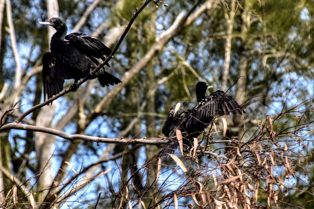
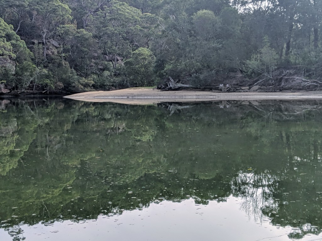
After a while, I beach the kayak on a sandy point and break for lunch. Remnants of a fire tell me I’m not the first person to pull up there, then I spot a walking track just a little inland – I’ll check that out another day. While I eat, I watch a group of young cormorants undertake flight training from one side of the creek to the other – unfortunately, they’re a little far and fast to capture with the camera.
The trip downstream continues at a good pace and it’s not long before I’m passing under the Roseville Bridge again. Passing by Killarney Heights, I spot a Weber kettle barbeque and a few chairs perched on a bluff above the river – what a great place to hang out cooking steaks and drinking beers on a summer evening!

On the upstream paddle, I’d noticed some old buildings in the distance in Bantry Bay, so I head in to check them out. They’re beautiful old brick structures, seemingly still in good condition, although there are warning signs to keep out. A later Google search reveals they’re explosive storage buildings established in the early 1900s.
Bantry Bay is a pleasant haven, and being Friday afternoon, the first of the pleasure boats are heading in to claim the small number of public moorings for the night. I point the nose due south to check out Sailors Bay before I lose the light.

It’s a pretty quick in-and-out, and there are other inlets further south I could spend time exploring, but sunset is approaching. So maybe that’s another outing.
Passing under the Spit Bridge again, I pick my way through the mega-yachts and beach the kayak. I’m still dry after five hours in the cockpit, which I think is a pretty good result for a casual paddler. But the boat tips as I get out, and with wobbly legs, I end up arse-deep in the salt water. Oh well, the perfect day can’t always end perfectly…

Leave a comment