Lane Cove River Local Loop
June 29, 2019
It’s easy to become a bit complacent about your local walks. They’re right there when you need a bit of exercise or headspace, but you tend to overlook what makes them special because they’re, well, familiar.
The bushland around the Lane Cove River is my backyard, and I have a whole bunch of tracks of varying lengths I can use to get my fix of outdoor exercise. I always enjoy it, but I haven’t carried a camera down some of these tracks for years.
A great place to start is Magdala Park on the banks of the river. I spent many pleasant Saturday mornings cheering, managing, scoring and manning the barbecue while my son played soccer and baseball here, and sure enough, there’s a North Ryde team on the pitch as I walk by.

The track starts at the back end of the oval, and quickly heads down to river level – mangroves to the left, eucalyptus forest and scrub to the right. It’s not long before I cross the bridge over Kitty’s Creek and join the boardwalk which spans the mangrove flats and saltmarshes.
Following recent rain, the path is slippery in places, particularly where there has been mossy build-up on stepping stones and timber boardwalks. Skirting Pittwater Road on the right side, the track heads up to a parking area, then heads left to Sugarloaf Point.

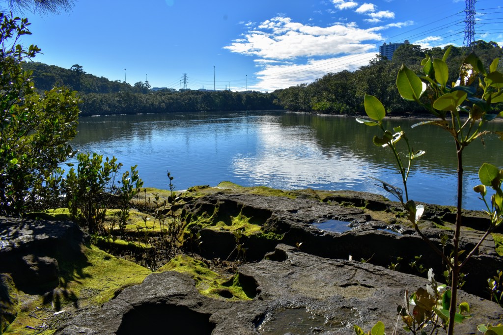
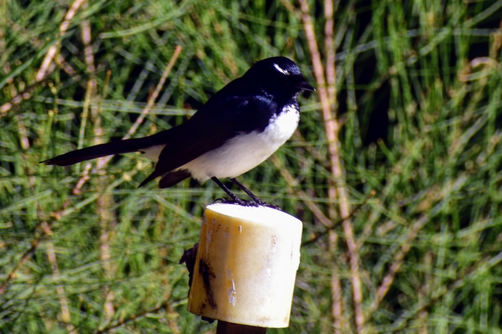
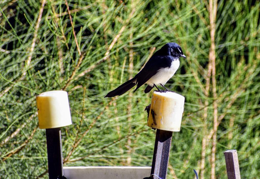
This is a great spot for a picnic with access to the water, great views up and down the river, and a lovely bush backdrop which is being augmented by a bush regeneration team. I spend a lot of time distracted by a couple of willy wagtails, trying to move close enough to photograph them before they flutter off.
I head back up the track and over the ridge, dropping down to Buffalo Creek, where the boardwalk carries me across the mangroves as the crabs scuttle into their holes in the sand. Up the steps to Buffalo Creek Reserve (which has a wonderful kids’ playground), then back into the bush across the boardwalk and past too many invasive house plants.
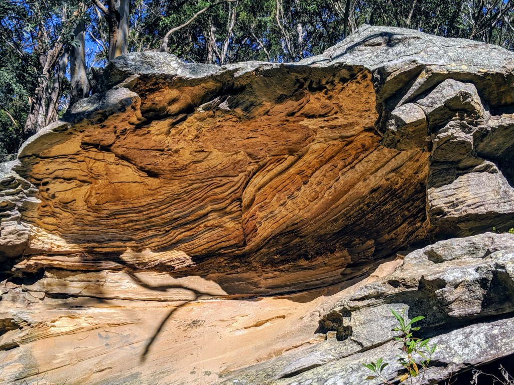
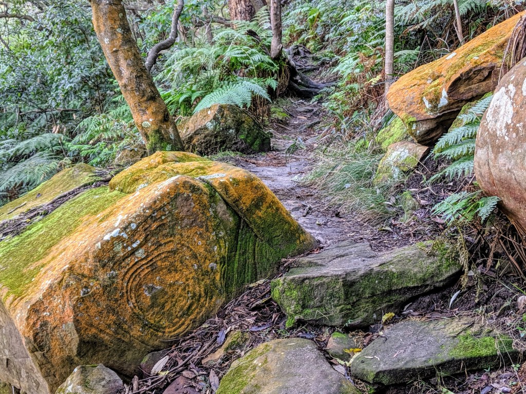
But along the way, there are sandstone outcrops, beautifully sculpted by the winds over the years. On the river side, the sandstone has been shaped and coloured by the water and the weather over many years.
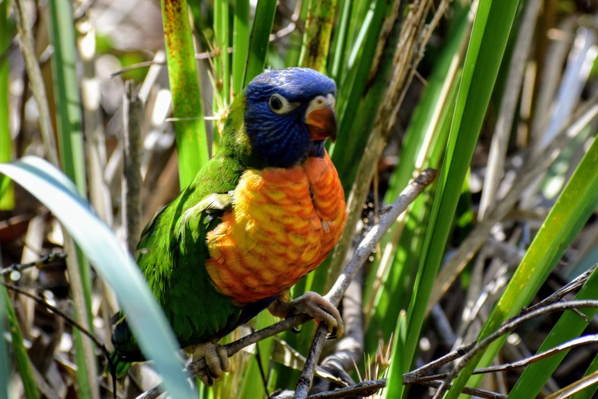
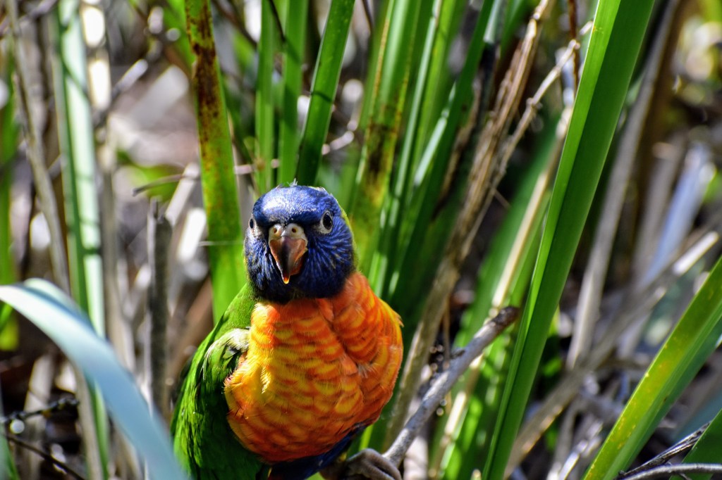
The track is well-defined, but irregular at times. As I walk down, I see a rainbow lorikeet in the native grasses alongside the track. This is unusual, and after my initial excitement at such a close encounter, I realise it has an injured wing. Apart from that, it’s pretty mobile, and while I consider picking it up and taking it to WIRES, I figure I’ll probably traumatise it more by doing so. It’s a wild animal, and nature will prevail.
The trail brings me to Boronia Park, where I have to head up Boronia St, go briefly along Ryde Road, then travel down Bonnefin Rd. The brick cottages built in the 1940s and 1950s are gradually being replaced by multimillion-dollar mansions. Some have absolute waterfrontages, and most have nice views, but I wonder about the value…

I walk under the Figtree Bridge, across it, and under it again, stopping briefly at the park on Cunningham’s Reach for lunch. Anglers young and old are trying their luck, and a couple of kayakers are setting off.
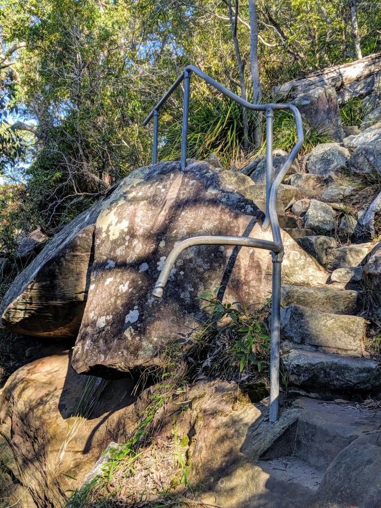
There is a roadway leading back to Burns Bay Road, or you can go right to the end of the reserve and climb a steep set of sandstone stairs. Whichever, it’s pavement for a few hundred metres uphill, but once you hit the mobile phone tower, you can leave the traffic behind and head back into the bush down a steep but navigable track.
This is one of my favourite parts of this track. Once you pass the next access from Burns Bay Rd, called The Boreen, the bush becomes damp, dark and lush. Apart from the usual eucies and shrubs, there is a mass of ferns – birds nests, fishbone and tree ferns. Once we move out of the shadows, the undergrowth gives way to bracken fern, but the track is still overshadowed by dry sclerophyll forest.
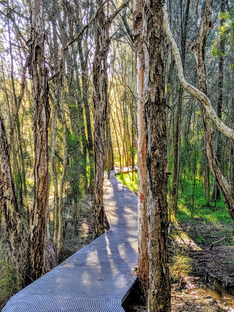
Blackman Park is a hive of activity – sporting fields, playgrounds, barbecue areas and an off-leash dog area. But you can move past this quickly, and head downhill to walk along the path alongside mudflats. After a while, there is a great boardwalk which threads its way between melaleucas and casuarinas, spanning the saltmarsh.
The track heads on through the casuarinas before entering a grassy wasteland and a bridge across Stringybark Creek. A boardwalk runs across the mangrove beds, before the track threads behind commercial buildings to meet Epping Rd.
A couple of hundred metres down the shared bike path, then I turn left to cross the footbridge over the starch works, which is brewing up a particularly stinky concoction today. But then I’m back at Magdala Park. The hill is a mongrel, but at the top sits the North Ryde RSL, which is as good a place as any to celebrate a good walk with a cold beer.

Leave a comment