Garigal National Park – The Cascades
September 11, 2019
Garigal National Park is one of the smallest in the Sydney area, nestled between well-known suburbs either side of Middle Harbour Creek and bounded by a couple of major roads. And it’s not that well known, apart from the Davidson Park picnic area, which teems with recreational visitors every weekend.
It’s also not that easy to get into Davidson Park, but once you do, it’s well worth it. Access is via Warringah Rd, southbound, just before the Roseville Bridge. Having navigated that, on a weekday morning, there’s no one around, so we head across the grasslands and soon leave the hum of the traffic behind.
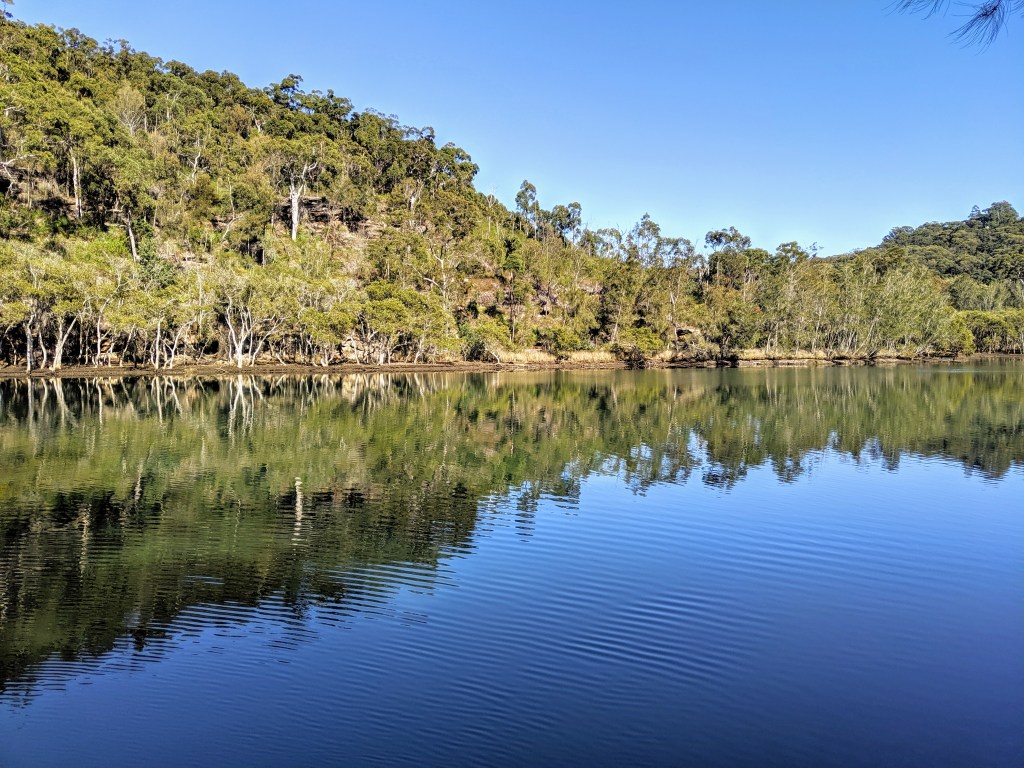
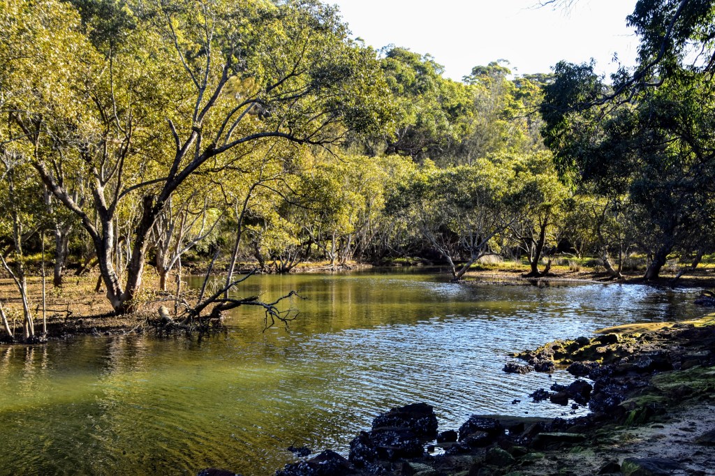
The track follows Middle Harbour Creek, which is incredibly still and reflects the blue of the sky as well as the mangroves, casuarinas, melaleucas and eucalypts which fringe the shoreline and the valley slopes. It’s easy, flat walking, and we’re constantly greeted with beautiful vistas across the creek as we round the bends.
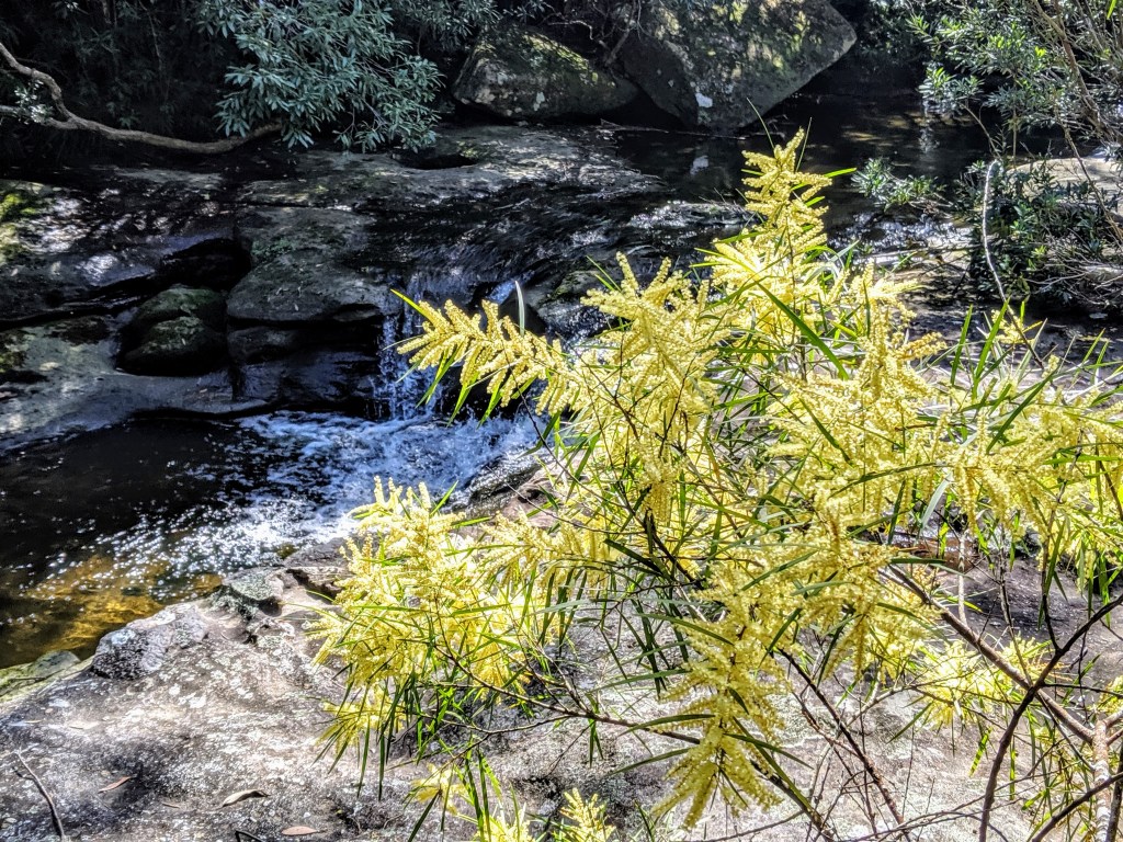
There are plenty of acacias in flower, but only a few other wildflowers. Regardless, there is a rich texture to the bush, as it flows from rainforest to dry sclerophyll. There is a great diversity of ferns, particularly, but plenty of other shrubs.
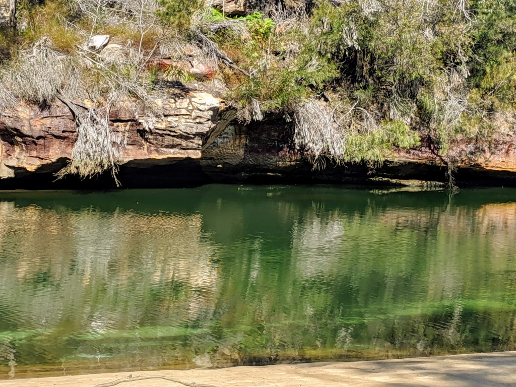
An incoming creek sends the track to the east until we can cross further up and return to the main waterway. As we head upstream, we find ourselves passing by sandy beaches and sandstone overhangs reflected in the still waters.
My walking app is a little fuzzy on where the track actually goes, but there are a few national park signs which keep us heading in the right direction. And it’s pretty well-defined, so a bit hard to get lost. We punch on past Stepping Stone Crossing (our route home) and head towards the Cascades.
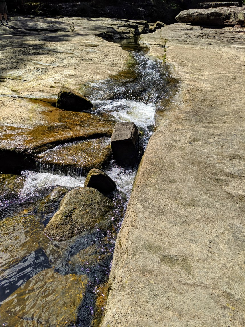
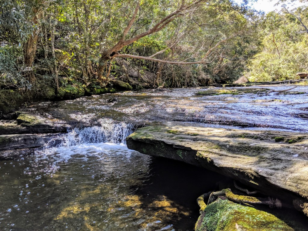
The Cascades were a complete mystery to me before setting out, but my walking mate was aware of them as a local secret. When Sydney copped a deluge in late August, they were apparently spectacular, but even a couple of weeks later they are incredibly beautiful.

The creek cascades (literally) over wide flat shelves of sandstone which are punctuated by long pools, not too deep, but you imagine they could be after a decent downpour. Much of the rock is exposed, but it is clear that the character of the area must change markedly depending on the water levels.
The water looks clean – and by Sydney suburban standards, it probably is – because the catchment is only lightly populated. It is certainly cool and refreshing, and as we head to the top of the Cascades, we spot a solitary eastern water dragon before stopping to chat about bushwalks, birds and wildlife with a couple of other walkers. By strange coincidence, we realise that we all attended the same high school, albeit (cough) a couple of decades apart…
Retracing the route is never my preference, but heading downstream provides a different perspective, and it is just as pretty either way. It’s fairly easy walking, and after a brief stop for lunch, we reach the junction taking us across the creek.

While the upstream track follows the creek fairly closely, our downstream option climbs up and down ridges, and pushes up gullies to traverse other creeks, which are uncrossable lower down unless you want to get wet feet! But as with the other side, the vegetation is diverse and interesting, ranging from mangroves & casuarinas lower down, to eucalypt forest and heath higher up. In one now-exposed section, burnt-out trees are gradually collapsing across the track, although ground covers, grasses and shrubs have recovered from the event.
Track quality is variable, at times it is challenging to figure out where the “real” track runs, as there are many local infeeds and animal trails. But the further south we head, the better the track gets, as we join the Two Creeks Track. We think we’ve crossed more than that, but one can’t get pedantic…

We missed the link track taking us back up to Roseville Bridge, but we worked it out eventually. Some signage would help here. After a toddle over the bridge in the afternoon sun, we headed down the slip road and re-united with the car.
Notwithstanding the challenges getting in and out, this is a quality walk. It’s right in the middle of suburbia, but you’d never know it based on the scenery and the ambience. If I did it again – and I will – I’d head up the western side of the river first so my cranky knees didn’t have to deal with the ascents and descents later in the day, but for most folks it’s a decent +/-20km wander with no pain.

Leave a comment