On The Emerald Edge

Exploring the shores of Lake Macquarie and beyond

Waratah Bay & Bobbin Head, from Berowra

April 17, 2019

There are often multiple tracks to get from one point to another in our national parks, and that’s definitely the case in Ku-ring-gai Chase. After toying with the idea of entering at Mt Kuring-gai (yes, different spelling), we opted for Berowra because, well, it’s just a better walk.

The entry point is north of the railway station and over the bridge spanning the freeway. The track is well-marked, well-maintained, and proceeds downhill at a comfortable grade, zigzagging down the ridge before connecting with Waratah Gully for the walk right down to Waratah Bay.

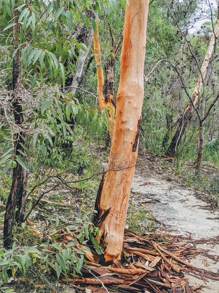
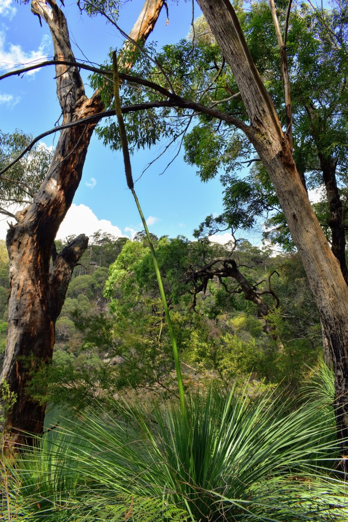
There wasn’t much water in the creek, but the rainforest was lush, and despite the relatively cool temperature, the humidity was pretty high. I’ll confess to not paying as much attention to this stretch as I should have because I was rushing to the river to try to get mobile phone coverage for a conference call. Surprisingly (thankfully??), coverage was non-existent despite moving around the bay, so normal focus on the bushwalk resumed.

Looking out across Waratah Bay, the footings of the old boat shed are encrusted with oysters and exposed at low tide

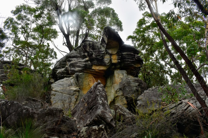
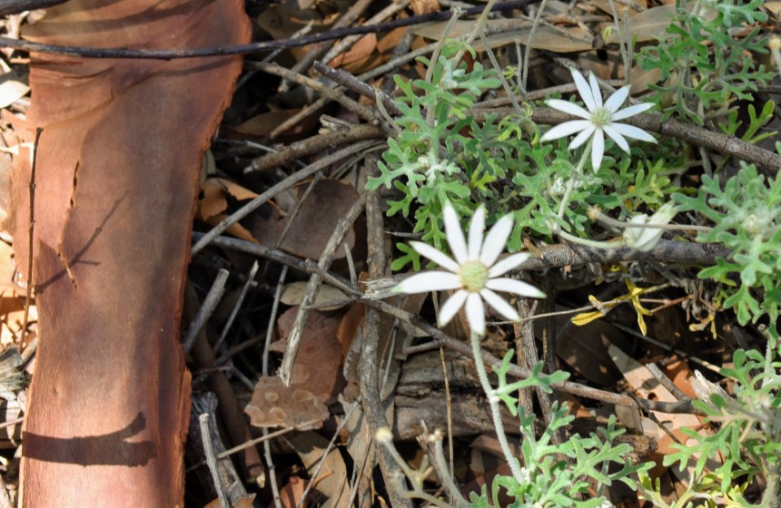
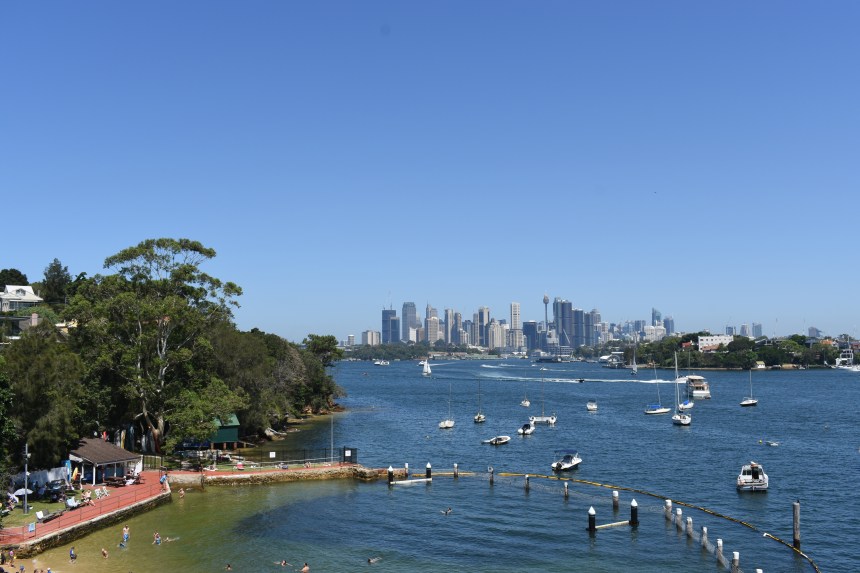
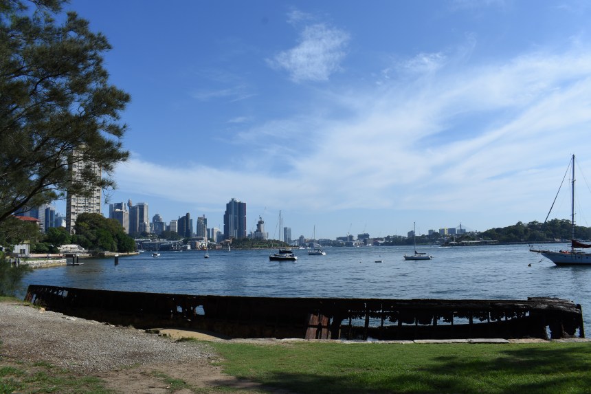
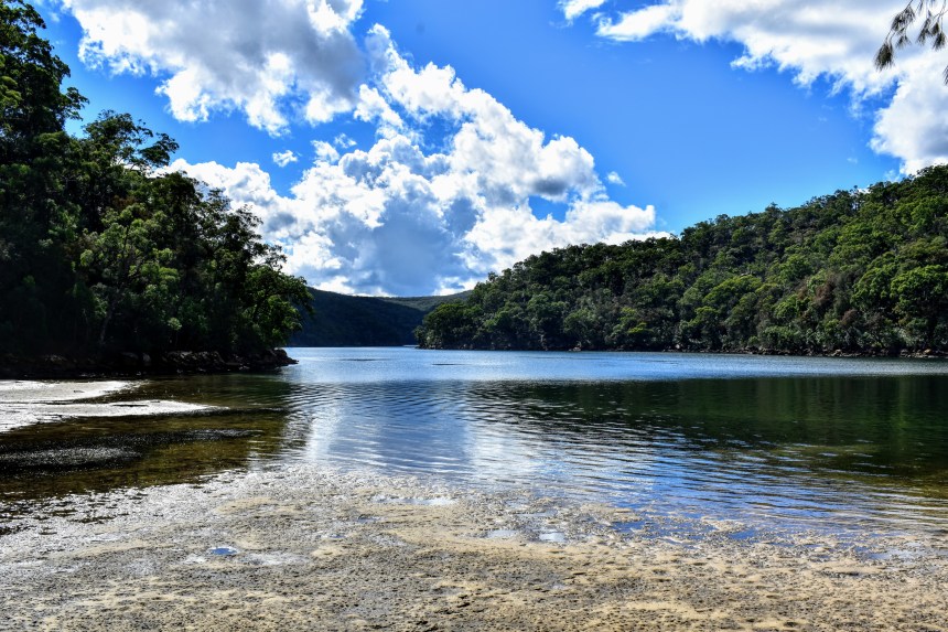
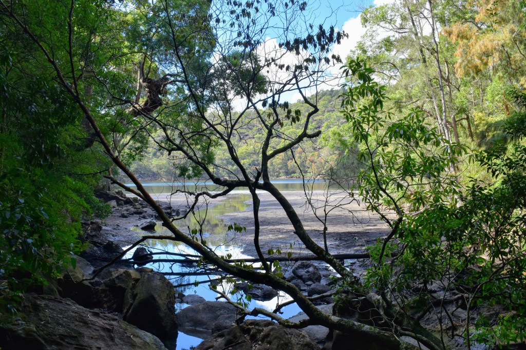
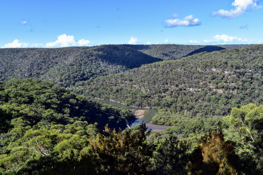
For me, this is the best reason for the Berowra entry compared with Mt Kuring-gai. The track runs along the edge of Cowan Creek for about three kilometres, tracking in and out of the bays, crossing Aboriginal middens, and always under the shelter of the eucies and she-oaks.

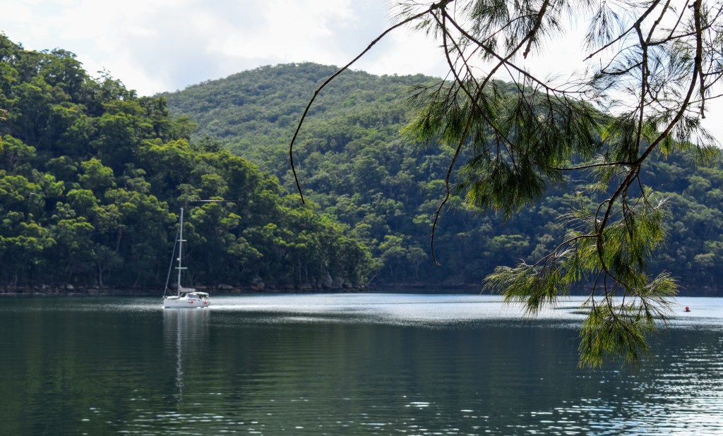
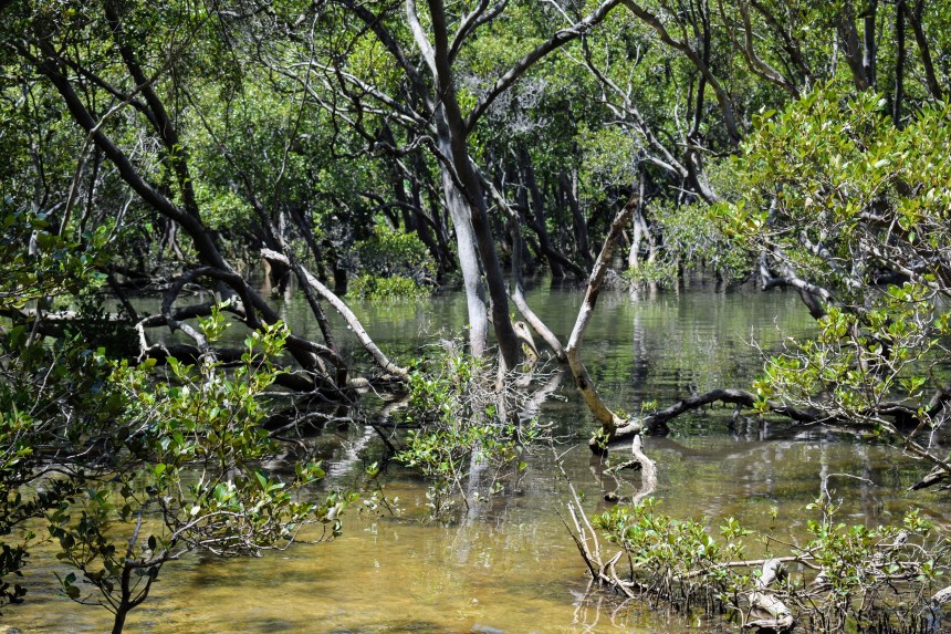
As you round the headlands, the views open out upriver and downriver, and the cormorants spend more time underwater than above, hunting the fingerlings. Inside the bays, the picture changes to moss-covered rocks and ferns, plus young mangroves poking through the low-tide sandbanks while the semaphore crabs scuttle away at our approach.

Not long before reaching Apple Tree Bay, we came across a massive goanna, spooked by a party approaching from the other direction. It took sanctuary on the trunk of a large tree, glared at us, then leisurely climbed higher, never ceding its right of belonging.

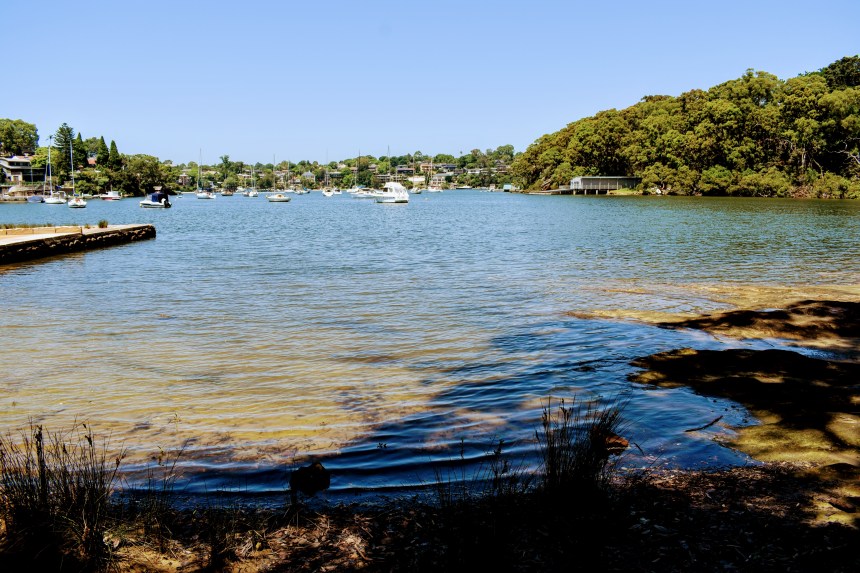
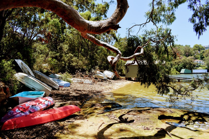
Over my lifetime, I’ve been to Apple Tree Bay countless times. My mother worked for at the Ku-ring-gai Chase park headquarters, so I spent many school holidays with a pretty good run of the park. Apple Tree Bay was a place for me to launch my kayak, but outside of some improvements in terms of access and parking, it’s still a pretty dull place to hang out.

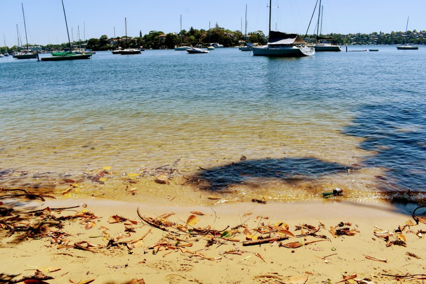
So we added another K walking along the road to Bobbin Head, which is a far more interesting place to break for lunch. My caffeine-deprived walking mates headed for the Bobbin Inn, and that’s where we spelled. But there are a few other ways you could spend your time.

Bobbo is a bit of a throwback in time. The picnic shelters date back to the early years of the 20th century, as does the Bobbin Inn, which has transmogrified from a genuine hotel to an information centre and cafe. But take a look at some old photos, and nothing much has changed. The marina is now populated with impressive and expensive leisure-craft, but there are still plenty of historic launches on the moorings.

The Halverson family operated the boatshed for many years, servicing and renting out their distinctive motor cruisers which they built at a couple of sites on Sydney Harbour. These classic craft are now highly-treasured, and are still a delight to see plying Pittwater. There’s a wonderful book Wooden Boats, Iron Men written by one of the family, if you’d like to explore more.

But onwards and upwards. Just behind the café is the entry to the Kalkari walk, and the initial tidy sandstone steps soon give way to a zigzag uphill, sometimes a little challenging for those of us with weary knees.

It’s worth pausing for a breath every now and then, because the views back down over Bobbin Head are pretty good, and there’s plenty to see along the track too. At one point, we find ourselves between two black cockatoos, just chatting.

The walking is pretty easy, and we find ourselves skirting the high fences of the Kalkari animal refuge, where injured animals are rehabilitated. The visitor’s centre is here also, and you can visit the Discovery Centre and walk around the enclosed section to learn more about the local flora and fauna. Kalkari has changed a lot since I was a teenager, but it’s still engaging and is certainly worth a visit.

From Kalkari, it’s a nice walk out of the park. The track roughly parallels the road but deviates occasionally and runs through dry sclerophyll forest, since we’re now at the top of the ridge. You hit the electricity lines occasionally, but hey, that’s suburbia.

Turn right after you cross the freeway, and head to Mt Kuring-gai railway station for the trip home. Sorry, no pubs here….

Cowan to Mt Kuring-gai, via Berowra Waters

Friday March 15, 2019

The day after Sydney experienced some of its heaviest rain in months is probably not the ideal time for a bushwalk, but the weather gods are with us and while the skies remain overcast, we are spared any rain. The humidity is pretty high, as you’d expect, but this just adds to whole rainforest vibe of this walk.

Five 50-something blokes – all of the others markedly fitter than me – kick off from Cowan, and the track is fairly gentle to begin with as we head down the gully. After a couple of kilometres, the fun starts, with a series of short ascents and descents which test my cranky knees.

Always good to get your boots a little wet

It’s great to see the creeks running as we navigate around sandstone outcrops and through the eucalyptus forest, which is punctuated by tree ferns and stringybarks. About five kilometres in, we get our first views of Berowra Creek, and then after another climb in and out of the creek gully, the village of Berowra Waters comes into sight.

Splendid views of Berowra Creek

Another steep descent and we’re on the shoreline, walking through the remains of aboriginal middens. Riverfront houses and boats at moorings come into view, then the “commuter carparks” for residents appear – tinnies and dinghies on the waterside, cars and vans just inland.

The Berowra Waters Ferry is an institution, one of only two in Sydney. And it’s free!

 A break on the outdoor deck of the café while the boys recaffeinate gives us time to watch the gentle pace of life in Berowra Waters – the punt ferrying vehicles back and forth across the creek, tinnies moving between the shore and boats at anchor, and couple of stand-up paddleboarders. Under the leaden skies, it is a calm and oddly pretty scene.

The climb was a little punishing, but the view from Naa Badu lookout is spectacular

There’s a pretty nasty push up the contours to get out of Berowra Waters, and we continue uphill on the advice that there’s a great spot for lunch further up. After bypassing some great sandstone platforms, we reach Naa Badu lookout, which offers great views upstream and downstream, plus a table and seats from which to enjoy them.

Angophora costata shed bark every summer – the colour stands out beautifully

We descend to creek level – yet again – and continue along the shoreline. It’s easy walking, with mangroves on one side and casuarinas on the other, with the limbs of many shattered eucies scattered in the scrub beside the track. It looks like a mini-cyclone has come through here in recent weeks, but the rangers have cleared the track.

The boardwalk through the saltmarsh, about the only really open stretch on this walk

The saltmarsh appears, and we mount the boardwalk to the intersection with the Calna Creek Bridge (this leads to Crosslands and beyond, but more of that in another post). After a break and another period of robust banter, we head off. Underfoot, the she oak needles are massed in thick layers, betraying the course of last night’s storm and the ensuing flooding.

We continue along the side of the creek, heading up Lyrebird Gully. This is temperate rainforest at its best, with a few creek crossings, ferns, vines and an overhanging canopy filtering the afternoon sun (which has emerged to amp up the humidity!). This walk is said to be one of the best and prettiest sections of the Great North Walk, and I can’t disagree.

Along the way are three sandstone overhangs known as Lyrebird Caves. Caves they ain’t, but they are great examples of the wind-carved cavities prevalent across the Sydney sandstone region. No doubt the original inhabitants took advantage of them, as they certainly offer protection from both sun and storms.

Temperate rainforest and running creeks (not potable) are within a kookaburra’s cry of suburbia

After another creek crossing, we’re into a clearing and onto a slow slog up the asphalted fire trail as we slip back into suburbia. There is a welcome water bubbler at the top, just before the highway, but sadly, Mt Kuring-gai lacks a pub! No probs, I found one on the way home.

The Stats:

Distance: About 18 ks

Ups & Downs: 900 -1000m both ways

The Watering Hole: The Railway Hotel, Hornsby

The Beer: 150 Lashes

What’s Nearby:

Kuring-Gai Chase National Park

Muogamarra National Park

Crosslands (recreation and camping area)

Sydney sandstone forms the perfect platform

Burns Bay to Milsons Point

Saturday January 12, 2019

One of the great things about walking the shores of Sydney harbour is that there are so many entry and exit points. Linley Point is one of the smallest and most tightly-held suburbs in Sydney, tucked between Lane Cove and Hunters Hill, on the shore of Burns Bay. Starting the walk at Linley Point Reserve, within minutes I’m across the other side of the bay, climbing into Riverview.

The route takes me past St Ignatius College (Riverview), a grand old sandstone Catholic boys school which enjoys an absolute waterfront location and some of the most stunning views along the Lane Cove River. But once I reach Tambourine Bay, I’m alone among the eucalypts, with only a bush turkey and several thousand cicadas for company. With the houses concealed by the trees and the mangroves screening out the harbour, it’s hard to believe I’m right in the middle of suburban Sydney.

Mangroves are the lifeblood of the harbour
Outlook from Tambourine Bay

Waterfront real estate is too valuable to make it all available to the average punter, so the bush tracks regularly spit you out onto local streets. But it’s not all bad, because there are some stunning heritage houses here, as well as some impressive new additions to pass the time before the parks and bushland reserves open up the waterside vistas once again.

This gorgeous old house sat above the street on a great piece of land
Flannel flowers growing among the bark shed by an angophora

The bays are home to hundreds of yachts and launches of all shapes, sizes, vintages  and price tags, while occasional sandy beaches are stacked with dinghies and kayaks above the high tide line.

The best place to hide your boat is near the water…
A view from the Longueville bushland

After Woodford Bay, I skipped Northwood, heading straight down to Gore Creek Reserve, where a game of cricket was underway on picturesque Bob Campbell Oval. Skirting the edge of the bay, I end up on the streets again, and head down Greenwich Rd, picking up the foreshore track again at Shell Park. This takes me Greenwich Point, from here there are outstanding views across to Cockatoo Island, and up the harbour to Goat Island, the Harbour Bridge and the city.

There are surprisingly many small beaches where you can walk straight into the harbour
Not your regular view of of Sydney – from Greenwich

Just around the point are the Greenwich Baths, a netted enclosure with city views, where local families play on the small sandy strip or float in the gentle swell generated by passing ferries. This is surely one of the most picturesque bathing spots in this part of the harbour.

Greenwich Baths have unparalleled views of the city

After heading back uphill past the oil terminal, I take a steep descent into the bush in Gore Cove Reserve, stopping to chat to a confident female eastern water dragon by the track, which ends at Berry Island Reserve. This was a traditional hunting, fishing and camping site for the local Cammeraygal people, and is now a well-equipped picnic area and an interesting bushwalk which includes historical information and some spectacular vistas.

A last vestige of Sydney Harbour’s industrial history, the oil terminal in upmarket Greenwich

A quick trek across the back of Balls Head Bay, and I’m tackling the long and steep staircase which abuts HMAS Waterhen, the navy’s mine warfare headquarters cut into the sandstone escarpment. From there, I head across Waverton park, through the back streets and into Sawmillers Reserve, the site of a sawmill from the late 1800s, which once again features outstanding and unusual views of the city and harbour.

The city from Sawmillers Reserve, North Sydney

Legs starting to weary by now, I head across to Lavender Bay, picking up the paved walkway which leads to Luna Park and Milsons Point. Suddenly there are crowds again – wedding receptions, dogwalkers, ferry-goers and thrillseekers. Back to reality, I head up the hill and under the bridgeto Kirribilli, where a welcome beer awaits.

The Stats

  • Distance: About 20km
  • Time: About 6 hours
  • The Watering Hole: Kirribilli Hotel
  • The Beer: 150 Lashes

Also Nearby

  • Wendy Whitely’s Secret Garden
  • The Coal Loader
  • Balls Head
  • Luna Park